HIKING, CAMPING & SIGHTSEEING - OH MY!
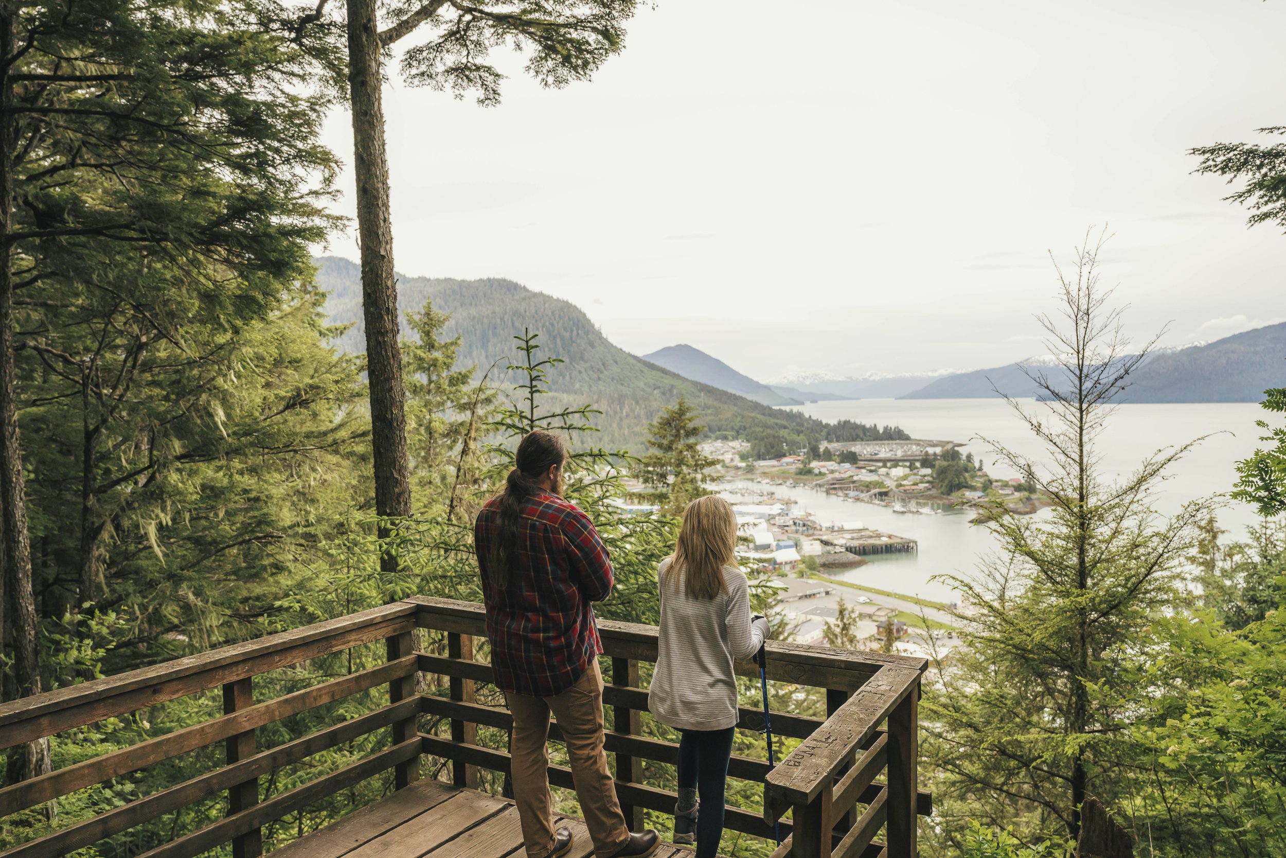
Scenic overlook looking at downtown Wrangell at the end of the Mt Dewey Trail.
Wrangell offers many scenic spots for picnicking and camping, from easily reachable City Park and Shoemaker Bay to the more remote Nemo Point and Salamander Creek campsites.
Mount Dewey Trail
Located right behind downtown, this large, tree-covered hill is a quick hike for a fine view of Wrangell and Zimovia Strait. A trail leads up the hill from downtown. Go up to Third Street behind the high school, or from Front Street take McKinnon Street heading away from the water to the set of stairs leading up past Reid Street, veer left at the top of the staircase and follow Mt. Dewey Lane until it hits Third Street. A sign pointing right shows the way to the trail.
Volunteer Trail
For a short but pleasant walk near town, head for Evergreen Elementary School and the baseball fields behind it. Taking either the route between the two fields or north past the tennis courts, you will find a gravel trail that meanders through the muskeg with interpretative signs pointing out particular flora and fauna, as well as occasional benches to rest on, courtesy of the U.S. Forest Service.
City Park
Located about a mile south of town on Zimovia Highway, the waterfront park is adjacent to a historic cemetery and an old baseball field now used as the community garden.
The park contains picnic tables, shelters and restrooms. Tent camping is restricted to 24 hours. Camping is not allowed inside shelters. Overnight parking is prohibited.
Avid cyclists may want to take advantage of the paved bike trail along the highway — it starts near the Public Safety Building and runs past Shoemaker Bay Park.
Shoemaker Bay
Shoemaker Bay RV Park is about five miles south of town, along Zimovia Highway. The park offers 25 sites open exclusively to RV and trailer campers – 15 with electricity, 10 without. All sites have excellent views of Zimovia Strait and neighboring Woronkofski Island. A freshwater pump is located near the entrance to the Shoemaker Harbor parking lot.
Facilities are on a first-come, first-served basis; no reservations taken.
There is a holding tank dumpsite for RVs is in the harbor parking lot. There are also restrooms and a dumpster. A tent camping area is located in a wooded spot near a creek. South of the creek is a tennis court, restrooms and picnic shelter. Tent campers should use the designated camping area only.
Inquire at City Hall at 907-874-2381 or Parks and Recreation at 907-874-2444 for rules.
Rainbow Falls Trail (moderate to difficult)
Just across Zimovia Highway from the Shoemaker Bay camping area is the Rainbow Falls Trail, which offers a self-guided hike through the pristine Southeast Alaska rainforest. A little less than a mile up the trail is a beautiful view of Rainbow Falls; a tenth of a mile later, the trail ends above the waterfall and provides spectacular views of Chichagof Pass, Zimovia Strait and surrounding islands. Viewing platforms and bench seating make this a great place for a picnic. The trail intersects with Institute Creek Trail.
Institute Creek Trail (difficult to most difficult)
If you choose to continue from the Rainbow Falls Trail, this trek offers many scenic views for an additional 2.7 miles (and a total 1,500-foot elevation gain) on the way to the Shoemaker Bay Overlook Shelter.
Shoemaker Bay Overlook Shelter
There’s a three-sided shelter, picnic table, fire grill and outhouse, as well as an excellent view of Shoemaker Bay Harbor, Zimovia Strait and surrounding islands.
North Wrangell Trail Difficult (most difficult)
This trail begins 2.2 miles from the Rainbow Falls Trailhead via the Rainbow Falls and Institute Creek trails. The trail leads 1.3 miles to the High Country Shelter and continues another mile to the Pond Shelter. Shelters are three-sided with a picnic table and an outhouse.
Hikers can also start on the opposite side of the island and travel over the mountain toward Shoemaker. This hike starts at the North Wrangell trail and ends at the Rainbow Falls trail. The trail, which is surfaced with boardwalk, begins about 3.6 miles down Ishiyama Drive, which locals often refer to as Spur Road.
Pats Lake
Pats Lake recreation area is 11 miles south of downtown Wrangell, at a crossroads where dirt roads branch off Zimovia Highway. The first road to the left goes by Pats Lake, while the second turnoff leads to Pats Creek. There’s pleasant hiking along an easy mile-long trail from Pats Lake, which follows Pats Creek as it empties into the sea. Several varieties of trout are found in the lake and creek. The creek also has a fall salmon run.
The turnoff to the right leads down to the water. A short walk north — and back across Zimovia Highway — leads to the mouth of Pats Creek to a sandy point, which is good for picnicking or a little seaside relaxation as well as an occasional haunt of local saltwater fly fishermen.